Thinking about selling riverfront or acreage around Plains and wondering how to get it in front of the right buyers? You are not alone. These properties are special, and the marketing needs to be just as thoughtful. In this guide, you will see the exact steps Deb follows to prepare, present, and promote riverfront, acreage, and rural residential listings so you get clear exposure and serious interest. Let’s dive in.
Why Plains riverfront needs a plan
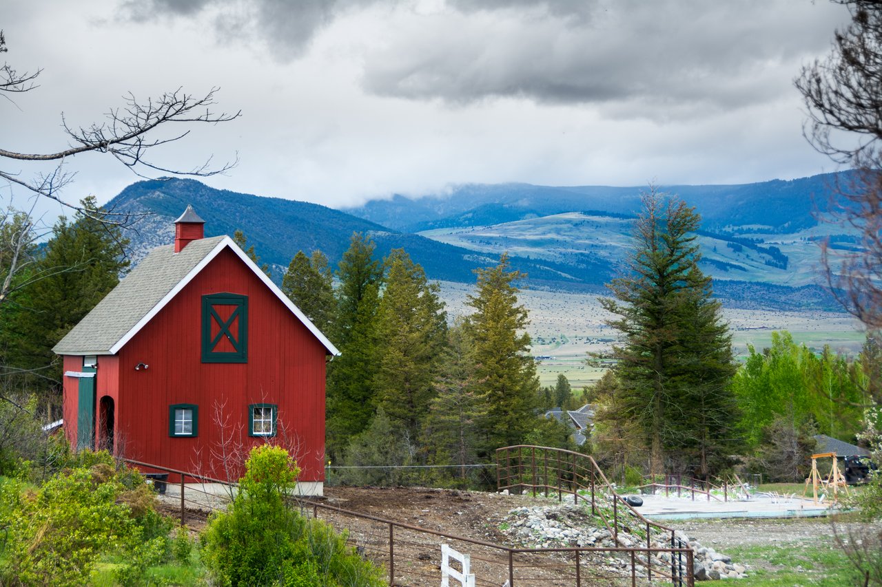
Plains sits along the Clark Fork River, which draws anglers, boaters, and second‑home seekers. That lifestyle appeal is real, but details matter. In Montana, public recreation on rivers extends up to the ordinary high‑water mark, so you need to set clear expectations about what is private and what is public. You also want to show buyers the usable ground, access roads, and utility status at a glance.
Deb’s approach brings all of that into focus. She pairs local knowledge with clear documentation and targeted distribution so qualified buyers can understand your land and act with confidence.
Pre‑listing groundwork
The strongest listings start with careful prep. Deb helps you gather and confirm the facts buyers care about most.
- Title, survey, and easements: Pull the deed, any recent survey, and recorded easements. If boundaries are unclear, Deb coordinates a surveyor referral.
- County mapping and parcels: Confirm parcel boundaries and right‑of‑way details using the official Sanders County GIS and plat resources. This keeps your marketing maps accurate.
- Water rights: In Montana, water rights are separate from surface land ownership. Deb summarizes what conveys and includes a copy or reference from DNRC water rights records so buyers have clarity.
- Flood risk: Deb checks the parcel on the FEMA Flood Map Service Center to note any mapped flood zones. She highlights buildable acres, access routes, and any lender or insurance considerations.
- Septic and well: Buyers of acreage expect basic utility facts. Deb documents well location and flow tests when available, septic type and permit status, and nearby utility availability. She follows Montana DEQ onsite wastewater guidance so the information you share is accurate and useful.
- Required disclosures: Montana includes a Mold Disclosure requirement, and agents must disclose known material facts. Deb includes a straightforward condition summary to reduce surprises and questions later.
Visual storytelling that sells land
Beautiful, honest visuals help buyers connect with your property. Deb curates a full media package so your land stands out online and in print.
- Hero photos: 8–12 crisp images, including a signature riverfront view and a clear build site or usable pasture. She preps the site for the shoot by trimming view lines and reducing clutter.
- Aerial and oblique views: Drone imagery shows frontage length, access roads, nearby public lands, and the overall setting. All flights follow FAA Part 107 rules with a qualified operator.
- Lifestyle photography: Simple, inviting scenes that show possibilities like fishing, river access, campfire spots, and sunset views. Short captions explain distances to Plains amenities and seasonal use.
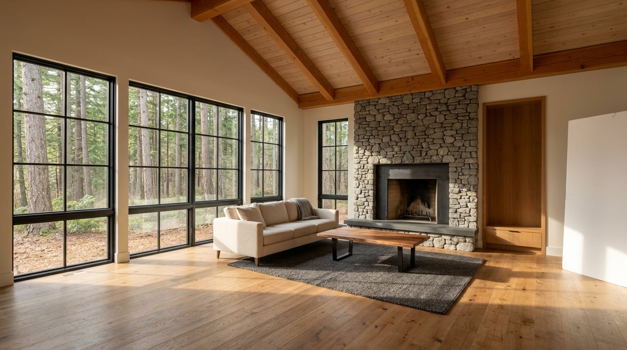
- Short video and 3D tour: A 1–2 minute highlight video mixes aerial clips and ground‑level shots. If there is a home or cabin, a 3D tour helps out‑of‑area buyers visualize the layout.
- One‑page feature sheet: A downloadable PDF covers acres, parcel ID, taxes, frontage length, easements, water rights summary, utilities, and showing details. That sheet travels well in broker tours and email.
Maps that answer key questions
Clear mapping is a must for riverfront and acreage. Deb packages maps that make the land easy to understand.
- Parcel boundary overlay: A clean parcel outline with section, township, and acreage, pulled from Sanders County sources.
- FEMA flood zone map: A labeled screenshot that identifies any 100‑year zones and notes insurance or lender basics from the FEMA Flood Map Service Center.
- Water rights summary: A short note with DNRC references stating whether rights convey and how they are used, plus any irrigation or diversion details.
- Soils and build sites: A simple NRCS Web Soil Survey summary and, when available, a concise note from a surveyor or engineer on buildable areas and driveway suitability.
This mapping suite helps buyers visualize the land, compare it with their goals, and move forward with fewer unknowns.
Listing launch and distribution
Once your assets are ready, Deb launches your listing with broad yet targeted reach.
- MLS entry: A complete photo set, clear description, and the feature sheet are uploaded for local agents and buyers.
- CENTURY 21 exposure: Your listing is pushed to the CENTURY 21 property search and brand channels, adding national visibility for out‑of‑area buyers who search by lifestyle and region.
- Land portals: Buyers who specifically search for acreage and riverfront use land‑first sites. Deb syndicates to the land‑specialty portal LandWatch and similar networks that support video, maps, and detailed land data. She also engages regional channels and community outlets that Plains buyers read.
The goal is simple: place your land where qualified buyers are already looking and give them enough context to take the next step.
Targeted buyer outreach
Riverfront and acreage attract distinct buyer groups. Deb tailors outreach so your listing shows up in their feeds and inboxes.
- Recreation buyers: Anglers, boaters, and outdoor enthusiasts respond to river‑forward media and access details. Deb targets social ads by interests and region.
- Second‑home and relocation buyers: Missoula, Spokane, Idaho, and Seattle are common feeder markets. Geofenced and interest‑based ads drive this audience to the property page.
- Hobby farmers and small ranch buyers: Practical data on soils, water use, fencing, and access speaks to this group. Deb shares your feature sheet with allied brokers and targeted email lists.
- Retirees and amenity seekers: Single‑level layouts, year‑round access, and proximity to town services are emphasized when relevant.
She also invites local brokers who work land to preview your listing. That broker tour often leads to fast, well‑qualified showings.
Step‑by‑step timeline
A clear schedule helps you prepare and stay informed.
- Day 0: Listing appointment and site walk. Deb reviews documents, water rights, flood maps, utilities, and sets a launch date.
- Days 1–7: Property prep, well and septic inspections if applicable, professional photo and drone shoot, map creation, copywriting, brochure design, property page setup.
- Days 8–14: MLS goes live, CENTURY 21 and land‑portal syndication, targeted social advertising, broker network emails, and broker tour.
- Weeks 3–6: Monitor views, leads, and showing quality. Refresh creative with seasonal imagery or a new video clip if needed. Adjust pricing or positioning based on feedback and data.
How success is measured
Not all clicks are equal. Deb focuses on quality and momentum.
- Key metrics: Listing impressions, property page clicks, number of qualified inquiries, showing count, offers, and days on market compared with local comps.
- Lead quality: For land and riverfront, proof of funds or lending readiness, a clear use case, and engagement with the mapping and feature sheet are strong signals.
- Reporting cadence: Regular updates summarize what is working, where buyers are coming from, and the next best move to keep interest strong.
What you can expect working with Deb
You can expect a blend of local insight and national reach. Deb’s decades in Sanders County help you position the story of your land with accuracy and care. Her CENTURY 21 affiliation adds strong distribution and trust signals for out‑of‑area buyers. Combined with rigorous documentation, visual storytelling, and targeted outreach, your listing has the tools it needs to perform.
If you are thinking about selling riverfront or acreage near Plains, you deserve a plan built for these properties. Reach out to schedule a quick consult and see how your land would be prepared, mapped, and launched.
Ready to talk strategy for your property? Connect with Deborah Warren for a local market consult.
FAQs
What makes marketing riverfront in Plains different?
- River access, flood mapping, and water rights are front and center. Deb sets expectations around Montana’s public stream use up to the ordinary high‑water mark and shows buyers which acres are usable and accessible.
How does Deb verify water rights for my acreage?
- She pulls a summary from DNRC water rights records to confirm whether rights convey, how they are used, and any priority details that matter to buyers.
Will flood zones hurt my listing’s appeal?
- Not if you are clear. Deb maps your parcel on the FEMA Flood Map Service Center, highlights buildable ground, and explains lender or insurance basics so buyers can plan with confidence.
Can drone photos be used for my property?
- Yes, with a compliant pilot. Deb uses operators who follow FAA Part 107 rules and a safe flight plan to capture the river, access, and setting from the air.
What documents should I gather before we list?
- Pull your deed, any surveys, recorded easements, tax info, well and septic records, and any water rights documents. Deb confirms parcel boundaries through Sanders County and organizes everything into a clear feature packet.
How will buyers find my Plains acreage online?
- Deb lists on the MLS, pushes to the CENTURY 21 property search, and syndicates to land‑focused portals like LandWatch so lifestyle buyers see your listing with full media and maps.