Picture your own basecamp near the Clark Fork River where you can fish at sunrise, glass for elk at dusk, and unwind under big Montana skies. If you are eyeing acreage around Thompson Falls, you likely want privacy and access to public land without surprises on wells, roads, or permits. This guide walks you through what recreational parcels look like here, the technical checks that protect your investment, and what drives value in this market. Let’s dive in.
Why Thompson Falls draws acreage buyers
Thompson Falls sits in the Clark Fork River valley and serves as the county seat for Sanders County. You get a small‑town pace, wide valley views, and quick access to miles of public land. Learn more about the setting and history by exploring the overview of Thompson Falls in the Clark Fork River valley.
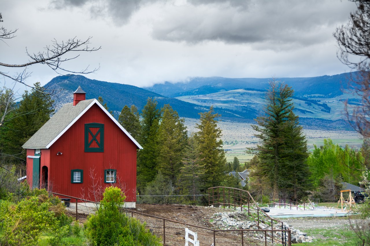
Local recreation anchors include Thompson Falls State Park for boating, fishing, and camping, and the Lolo National Forest’s Plains/Thompson Falls Ranger District for trails and access to vast public lands. These amenities are a big reason buyers seek river-adjacent tracts, forested acreage, and cabin sites here.
What “recreational acreage” looks like here
You will see a range of parcel types:
- Town or river lots near services. In and near town, some small lots have municipal water and sewer. That convenience is uncommon farther out.
- Forested 10–100+ acre tracts. Many sit near or next to National Forest, with steep terrain, springs or creeks, and stands of mixed conifers.
- Remote waterfront. Some parcels along the Clark Fork or tributaries are boat‑friendly or reached by seasonal roads. Listings sometimes note access is easiest by boat when roads are limited.
Each parcel type brings different due‑diligence steps on access, utilities, and developability. The sections below outline what to verify before you write an offer.
Access and roads: confirm you can get there
Montana Highway 200 is the primary east‑west corridor through the valley. From there, many acreages are reached by secondary and Forest Service roads, which can be rough in spring. Review the route and ask about closures using the overview of Highway 200 and valley access.
- Confirm year‑round, legal access. A recorded easement should show up in the title record or a current survey. Check the Sanders County Clerk & Recorder for deeds, plats, and easements.
- Ask who maintains the road. If private, find out who pays for plowing and repairs and if there is a written agreement.
- Expect seasonal conditions. Spring thaw can limit heavy vehicles on dirt or Forest Service roads.
You can start record searches with the Sanders County Clerk & Recorder.
Power, internet, and basic services
Thompson Falls has an operating hydroelectric dam that has shaped local power infrastructure for decades. Learn more about the project through NorthWestern Energy’s hydropower overview.
- Power. In town and near existing lines, power may be available or close. Farther out, plan for service extensions or off‑grid systems. Confirm the exact status at the specific parcel.
- Internet and cell. Coverage varies widely by elevation, tree cover, and distance from towers. Verify with carriers for the parcel before you commit.
Water and water rights: know Montana rules
Montana follows prior appropriation for water. Most surface water uses and many groundwater uses require a recorded water right. Exempt domestic wells have specific limits and new procedures you must follow.
- Exempt wells. Historically, small domestic wells could be exempt if they pumped 35 gpm or less and used 10 acre‑feet or less per year. DNRC guidance now requires a Notice of Intent before using an exempt well, with DNRC responding within 10 business days. As of current guidance, the Notice of Intent process takes effect January 1, 2026.
- Combined appropriations. Multiple wells from the same source can be treated as one appropriation for the 10‑acre‑feet limit.
- Due diligence. Pull well logs if available, have a licensed driller perform a pump test, and run a DNRC water‑rights search for the parcel.
For updates and forms, see DNRC’s page on exempt well rules and Notices of Intent.
Septic and wastewater approvals
Outside municipal sewer areas, the county oversees wastewater systems. Before you rely on a seller’s statement about an existing septic, confirm records and the system’s fitness for your intended use.
- Site evaluation and perc. Schedule a site evaluation with a county‑licensed evaluator and complete any required percolation testing.
- Permits and design. Make sure the system design is approved for your planned bedroom count and use.
Start with Sanders County Environmental Health for procedures, forms, and evaluator lists at Environmental Health, wells and septic.
Floodplain and riparian checks
Riverfront parcels along the Clark Fork can sit in FEMA flood zones and may be subject to setbacks, erosion risks, or reservoir operation changes near the dam. Protect yourself by checking the FEMA map layer, the county’s flood overlays, and any project rules near dam areas. You can contact county departments through the Sanders County Clerk & Recorder portal and ask NorthWestern Energy about hydropower operations that might affect recreation and safety near the project area.
Timber and forest management basics
Many private parcels here support ponderosa pine, western larch, and Douglas‑fir, with spruce and fir at higher elevations. For a quick primer on local species, see the Forest Service overview of ponderosa pine.
- Timber value. Merchantable timber can add value, but roads, logging costs, and riparian buffers reduce net proceeds. If timber value matters, hire a professional to estimate volume and access costs.
- Compliance. Harvesting near streams requires adherence to state best management practices and Streamside Management Zone rules.
Minerals and title considerations
In Montana, the mineral estate is often severed from the surface estate. That means mineral rights might be owned by someone other than the surface owner. Review the deed and title commitment for mineral reservations, and understand potential impacts on future use. For recorded documents and plats, start with the Sanders County Clerk & Recorder.
Wildfire risk and insurance
Western Montana landscapes face seasonal wildfire exposure. Fuel conditions, topography, and access can affect insurance availability and cost.
- Planning. Ask the local fire district about defensible space expectations and any active fuel‑mitigation programs.
- Community work. Sanders County participates in community wildfire planning efforts; the Forest Service maintains resources related to community programs and grants. You can explore related materials through the USFS page on community wildfire grants and proposals.
What drives value on acreage here
Several factors consistently influence pricing and buyer demand:
- Water. River frontage, reliable springs, or a high‑yield well command premiums.
- Access. Legal, year‑round access on a maintained road is highly valued. Seasonal Forest Service roads can lower pricing.
- Utilities. On‑site or nearby power and an approved septic plan reduce development costs.
- Public land adjacency. Bordering National Forest or State land for immediate recreation access usually adds value.
- Timber. Usable volume can contribute to value, offset by logging and road costs.
- Wildfire and insurance. Higher fire risk or difficult access can reduce demand and increase carrying costs.
Your step‑by‑step due‑diligence checklist
Use these contingencies and tasks to protect your purchase. Build reasonable timelines into your offer so you have time to verify each item.
- Parcel and title records
- Pull the deed, plats, recorded easements, covenants, and any mineral reservations with the Sanders County Clerk & Recorder.
- Confirm legal access and any private road maintenance agreements.
- Survey and boundaries
- Commission a current boundary survey if corners are unclear or waterfront frontage matters to you.
- Water, wells, and rights
- Hire a licensed driller for a pump test and review well logs if available.
- Run a DNRC water‑rights query and confirm whether an exempt well is allowed. If you plan to rely on an exempt well, review the new Notice of Intent process and timeline on the DNRC page for exempt well updates.
- Septic and percolation
- Schedule a site evaluation and perc testing with a county‑licensed evaluator. Confirm any existing system is permitted for your intended use through Sanders County Environmental Health.
- Floodplain and riparian
- Check FEMA maps and the county flood overlay. For parcels near the dam or reservoir, contact NorthWestern Energy about operating rules that might affect use or safety.
- Timber and vegetation
- If timber value is material to your offer, obtain a timber cruise and estimate road and harvesting costs. Follow state BMP and SMZ rules near waterways.
- Public lands and road status
- If you will rely on Forest Service roads or trails, confirm road status, seasonal closures, and any special‑use considerations with the Plains/Thompson Falls Ranger District.
- Wildfire and insurance
- Speak with the local fire district about defensible space and mitigation programs. Check availability and cost of fire insurance. Explore USFS community resources on wildfire grants and proposals.
- Title insurance and closing
- Require a title insurance commitment and set contingency deadlines that allow you to complete these checks.
- Local experts
- County Environmental Health staff, DNRC Water Resources, and the local Ranger District can answer specific technical questions. A local, land‑savvy agent can coordinate tests and contacts.
How a local agent helps you win acreage
A successful acreage purchase blends lifestyle goals with rigorous due diligence. You need a guide who knows which access routes wash out in spring, how the county handles septic approvals, and where to confirm water rights fast. You also need someone who can coordinate surveyors, drillers, and evaluators on a tight inspection clock.
If you are comparing parcels across the valley, a locally rooted agent can help you weigh trade‑offs like year‑round access versus deeper privacy, or timber value versus logging costs. You will move faster, negotiate smarter, and avoid expensive surprises.
When you are ready to explore acreage near Thompson Falls, reach out to Deborah Warren for a local market consult. Deb combines decades of Sanders County experience with full‑service buyer representation and the reach of CENTURY 21 to support you from first showing to closing.
FAQs
Do I automatically have water if a property has a well?
- Not always. Verify the well log, current yield, and any recorded water right. If you will rely on an exempt well, review and follow DNRC’s Notice of Intent process and limits before use.
Can I cut and sell timber from my acreage near Thompson Falls?
- Generally, private owners can harvest timber, but you must comply with state best practices and Streamside Management Zone rules, and consider road and hauling costs. A professional timber appraisal can help you understand net value.
Does bordering National Forest guarantee hunting access from my land?
- Adjacency provides immediate access to public land, but your camp and parking must still follow private‑land rules. Confirm road and parking details with the Plains/Thompson Falls Ranger District.
How do I check flood risk on a riverfront parcel along the Clark Fork?
- Review FEMA flood maps and the county’s flood overlays, and ask NorthWestern Energy about any reservoir or dam‑area rules that affect recreation and safety near the project.
Who issues septic permits in Sanders County?
- Sanders County Environmental Health oversees wastewater permits, site evaluations, and percolation procedures. Confirm any existing system’s records and approvability for your intended use.